New Dolores Canyons Mapping Tool
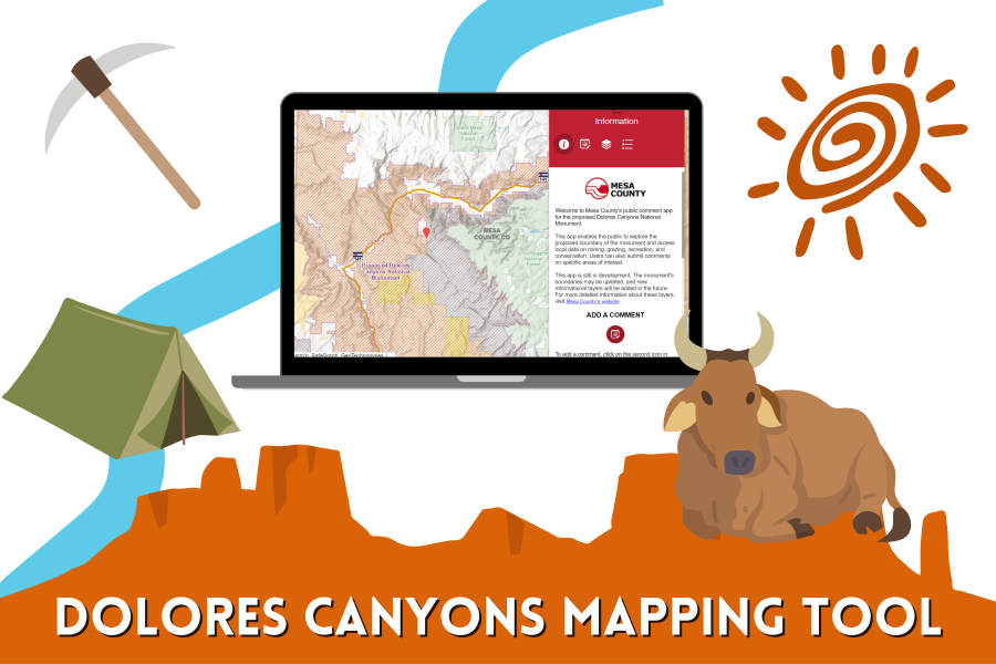
Mesa County has launched a new interactive mapping tool for the proposed Dolores Canyons National Monument. This app enables the public to explore the proposed boundary of the monument and access local data on mining, grazing, recreation, and conservation. Users can also submit comments on specific areas of interest.
For instructions on how to use the tool, please see the information panel in the app.
Please limit the number of comments per person, so that everyone has an opportunity to share their feedback. The best comments are constructive, relate to a specific area and expand on the information and boundaries provided in the GIS layers.
For more information, and to contact your local representative, visit the county's Proposed Dolores Canyons National Monument page.
The geographic information was obtained from listed sources no later than April 1, 2024. However, Mesa County cannot guarantee the accuracy, completeness, or suitability of the information provided. Users are responsible for verifying the accuracy of the data and for the appropriate use and interpretation of GIS information. Mesa County is not liable for any errors, omissions, or misuse of the data by users.