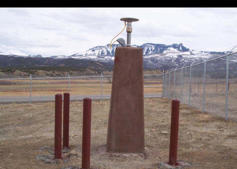
R301 - Crawford
Continuous Operation Reference Station (CORS)
In cooperation with CDOT Region 3
Location: 80088 Hwy 92, Crawford, Colorado
- Trimble Alloy / Zephyr 2 Geodetic Antenna / Trimble Pivot Platform
- L1/L2 APC - datum: NAD83(2011)
- Latitude: 38° 39' 23.73973" N
- Longitude: 107° 35' 27.36713" W
- HAE:2025.063m
- APC NAVD88 orthometric height = XXXXX
RTVRN Corrections only
RINEX hourly files 24hrs / 7days
GPS specs: 1 second intervals / 5° Elev. mask / 99.0 PDOP mask
RINEX index and general download directions
For more information including login/password for the RINEX files, contact the CORS administrator at 970-244-1826 or trent.howell@mesacounty.us.
Disclaimer and Limitation of Liability
Mesa County, Colorado, shall in no event be liable or responsible for any lost profits or any damages of any kind, including but not limited to special, indirect, or consequential damages arising out of or in connection with the use or the inability to use the data hereon or the services provided. Mesa County provides this data and its services as a convenience to its customers. Furthermore, Mesa County reserves the right to change, revise, or otherwise discontinue published data and these services at any time without further notice.